Here's a number that surprised me when I first calculated it: on projects where field survey data required a full or partial resurvey, the average total cost — resurvey labor, LLD redesign hours, schedule compression, and in some cases permit resubmissions — ran 5.3 times the original survey cost. Not 50 percent over. Not double. Five times.
That ratio has held across a dozen projects over the past four years. And it makes sense once you understand the compounding nature of survey errors inside a live design process. A wrong attachment height at pole 47 doesn't just affect pole 47. It affects the make-ready calculation for that span, the loading analysis for adjacent poles, and if the error gets far enough downstream, the clearance diagram in the permit package. By the time someone catches it — usually during LLD QC or, worse, when the permit reviewer sends back comments — the redesign touches things that were never near that original error.
This piece is about the specific mechanics of how field survey data quality problems develop, what they actually cost, and what a survey has to include to support BEAD subgrantee design work without triggering a mid-project resurvey.
What Bad Survey Data Actually Costs
The direct cost of a resurvey on a 15-mile aerial route runs $28,000 to $45,000. That's field labor, equipment, and the GIS processing to get the corrected data into a usable deliverable. Painful but recoverable — if the resurvey is the only consequence.
It rarely is. What actually drives the total cost is what else is in motion when the survey error gets discovered.
On a 2024 project in rural eastern Tennessee — a 19-mile BEAD-eligible aerial route — the survey crew missed attachment heights on 31 of the 214 poles they walked. Not all 31 had issues. Twelve of them did: attachment positions that were below the minimum communications zone when the NESC clearance calculation was run correctly. The design team had used the estimated heights from the original survey package, which ran 6 to 18 inches high on poles where the crews were estimating by eye rather than using a laser range finder.
The correction cost broke down like this: $34,000 for a partial resurvey of the 31 poles, 52 engineering hours at $162/hr to redesign the affected spans and re-run loading calculations — $8,424 — and a 3-week delay that pushed the permit submission past a VDOT comment window, triggering a resubmission fee and another 4-week review cycle. All told: $73,000 in recoverable costs and 7 weeks of schedule, on a survey that had originally cost $11,500.
That's a 6.3x multiplier. Not a rounding error. A real project outcome from a survey error that was completely preventable.
The Errors That Show Up at LLD QC
After reviewing survey packages on 40-plus projects, I've noticed that the same categories of errors surface repeatedly. They're not random. They follow patterns tied to how the survey crew was trained — or wasn't.
Missing or estimated attachment heights. This is the most common and the most consequential. NESC Table 232-1 specifies minimum vertical clearance requirements for communications attachments relative to the power conductors above. If you don't have the actual measured height of every existing attachment on a pole, you can't calculate whether your proposed attachment position satisfies those clearances. Crews that estimate heights visually are typically high by 6 to 24 inches — and that sounds like a small error until you're attaching in a zone with a 10-inch clearance window above a 7.2 kV secondary conductor.
Unverified pole IDs. Pole identification numbers that come from a field sketch rather than from the utility's GIS export. The crew writes down "Pole 7-341-A" from a tag on the pole. But that tag hasn't been updated since 2009, and the utility's system now lists that pole as "P2-1847." When the pole attachment application goes in with the wrong ID, the utility can't find the pole in their system. The application sits. Someone has to go back in the field to figure out what the current record ID is. That's one pole — now multiply it by the 18 poles on that segment that had similar issues.
GPS coordinates below permit accuracy standards. Consumer-grade GPS on a phone or a basic handheld unit gives you 3 to 8 meter accuracy under tree cover. That's fine for Google Maps. It's not fine for a permit submission to a state DOT that requires georeferenced drawings with coordinate accuracy to within 1 meter, or for import into a GIS system where the network operator manages their plant to sub-meter standards. Drawings produced from 5-meter GPS data fail the coordinate accuracy spec. Resubmission required. Clock resets.
Missing make-ready conditions. The survey crew walks the route and records pole ID, class, height, GPS. They don't look up and assess the existing attachment configuration — how many existing attachments, what their positions are relative to the communications zone, whether there are overlashing situations, anchor guys that would conflict with a new attachment, or down-guys that require relocation. A design team working from that data doesn't know what make-ready work is needed until they're deep into LLD — or until the field crew shows up and calls in to report that the pole is not what the drawings show.
Why General Contractor Crews Miss the Critical Stuff
I don't want to be dismissive about this. General contractors who survey their own routes are often doing good work by general field standards. They're walking the corridor, documenting what they see, and producing a deliverable that's adequate for most construction purposes.
But "adequate for most construction purposes" and "adequate for LLD-ready telecom design" aren't the same thing. The gap is specific and technical.
A GC survey crew knows how to GPS a pole and record its physical attributes. They can identify the pole owner, estimate the class from the circumference, note the condition. What they don't typically know is: what height does the secondary power conductor sit at on this pole, how does that relate to the proposed communications attachment zone, and is there a make-ready conflict that the design engineer needs to account for before committing the route segment? That's telecom-specific knowledge. It doesn't come from walking a lot of routes — it comes from training on NESC clearance requirements and hands-on experience with make-ready assessment specifically in the context of fiber attachment design.
So you end up with survey data that passes a visual review and looks complete. Then it reaches LLD QC and the design engineer flags 23 poles with insufficient attachment height data. Not because the crew was careless. Because they didn't know what "sufficient" meant for this use case.
What does that gap actually cost the project schedule? Usually 3 to 6 weeks when it triggers a partial resurvey, and 8 to 12 weeks when it requires a full one.
What a BEAD-Grade Field Survey Actually Includes
On BEAD projects, "good enough" survey data doesn't clear the bar. The NTIA documentation requirements and the scale of these deployments mean that survey data quality problems surface in multiple places — LLD QC, permit submissions, and BEAD compliance documentation — and they all carry their own remediation costs.
A survey package that supports BEAD aerial design without triggering remediation needs to include all of the following:
- Pole IDs cross-referenced to the utility's GIS export or NJUNS records — not transcribed from field tags
- Measured span lengths using a laser distance meter or wheel — not estimated or pulled from mapping tools
- Laser-ranged attachment heights for every existing communications attachment on each pole, referenced to grade
- Pole class and height from the physical manufacturer stamp — not approximated from visual inspection
- GPS coordinates accurate to 1 meter or better using survey-grade GNSS equipment or differential correction
- Make-ready conditions: existing attachment configurations, anchor guys, down-guys, clearance conflicts, and any visible structural issues that affect attachment feasibility
- Photographs of each pole with the pole tag visible in frame and a reference scale marker
- Deliverables in CAD and GIS formats with coordinate reference system documented — not just a PDF of field notes
That last point matters more than it sounds. A PDF of field notes is not a design-ready deliverable. It's source material that someone has to manually digitize before LLD can start. The digitization process introduces transcription errors — and it takes time the project schedule doesn't have. A professional CAD/GIS deliverable from the survey crew eliminates that manual step entirely and puts the data directly in the format the design team works in.
Real-world note: On a 2025 project in northwestern Mississippi — 23 miles of aerial on a mixed IOU/cooperative corridor — we ran a QC pass on the survey data before releasing it to LLD. Flagged 47 poles with attachment height data that was estimated rather than measured, 11 poles with pole IDs that didn't match the cooperative's GIS export, and 8 poles with GPS coordinates showing a 4-to-6-meter offset from the utility's feature class. The survey crew had done everything they were hired to do — they just weren't hired to do telecom-grade survey work. Partial resurvey took 6 days and cost $18,300. That QC gate before LLD saved the project from discovering those same issues 8 weeks later, mid-design, when the remediation cost would have been two to three times higher.
The LLD Gate You Shouldn't Skip
The cheapest place to catch survey data problems is before LLD starts. Not during LLD. Not at LLD QC. Before the first drawing sheet is touched.
A structured survey QC gate takes 1 to 3 days depending on route length and data volume. It checks completeness — confirming all required data fields are present for every pole. It verifies cross-reference integrity against the utility's system. It checks GPS accuracy against aerial imagery. And it flags the specific poles that need correction before design work begins.
Running that gate adds cost upfront. For a 20-mile route, typically $2,800 to $4,500 in engineering time. It feels like overhead. But consider the alternative: releasing LLD on a survey with 18 poles worth of bad attachment heights, building 60 percent of the design on that data, and then discovering the problem at QC.
At that point, the resurvey cost is the same. The redesign labor is new. The schedule impact compounds. And if any of those 18 poles are near a permit-required crossing that's already been submitted, you're potentially restarting a permit review cycle that was 60 days into its timeline.
The math on the QC gate isn't close. It should be a standard line item on every fiber project budget — treated the same way you treat a soil boring report on a buried conduit job. You don't skip it because it feels like overhead. You budget it because it costs far less than finding out after the fact.
Our OSP engineering process includes a formal survey QC gate before LLD begins on every BEAD project. It's not optional, and it's not an upsell — it's part of how we avoid the redesign cycles that kill project schedules.
How Draftech Handles Field Survey for BEAD Routes
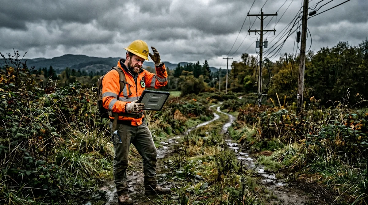
Our field survey crews are OSP-trained. That distinction matters in the specific ways I've outlined above — attachment heights are measured with laser range finders, pole IDs are cross-referenced against utility GIS exports before the crew leaves the corridor, make-ready conditions are assessed and flagged in the deliverable rather than left for the design team to discover.
Deliverables come in CAD and GIS formats — AutoCAD-compatible DWG with our full layer schema, GIS feature exports in Shapefile and GeoJSON with NAD83 coordinate reference system documented. GPS accuracy is 0.8 meters or better using differential correction on survey-grade GNSS equipment. Every pole gets a photograph with the tag visible and a reference stake in frame.
Our standard QC pass runs before data is released to the design team — not after. That means when LLD starts, the design team is working from verified data, not from a best-effort field package that might have 11 poles worth of problems in it.
For BEAD projects specifically, we also document the survey methodology in a format that satisfies NTIA compliance recordkeeping requirements. That documentation becomes part of the project's engineering compliance record — not an afterthought at closeout.
If you're evaluating your current survey process or considering a BEAD route that needs field survey and LLD together, reach out at info@draftech.com or check out our free design offer — we'll engineer the first 3.8 miles at no cost so you can see what a properly surveyed, properly documented design package actually looks like before you commit your whole project to a process that might not deliver it.